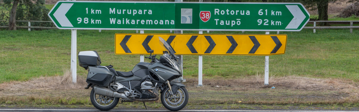
This years TT25 started for me on the 15th of October 2024 when I saw the route was up. I quickly downloaded it so I could get the start and finish locations. To me this determines how many days off I need and how much cover for work I must find. This year it will be two-night shifts and one day shift I need to find cover for. Hope I can find it as I have already spent about$800 for the 2025 edition.
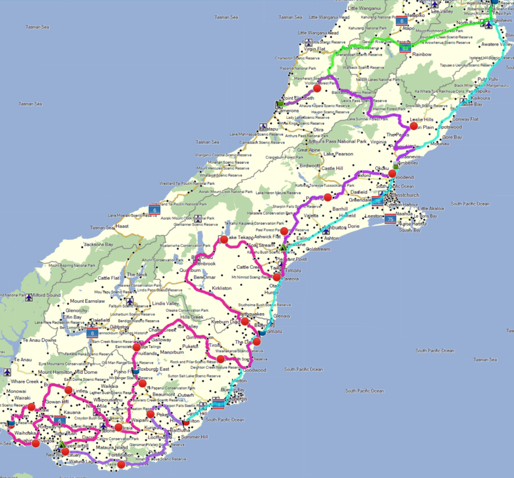
The route this year has to do with communities and halls. There is a pre-planned route that has 2000 points and 2000km available so downloaded that. I then booked the Bluebridge ferry both ways because of the cabins and the timetable. InterIslander timetable sucks especially coming back. I need to be back in Picton by 18:15 if I want to catch my ferry home. They will transfer me to the next one but that isn’t until 2am so really need to hand my card in and be on my way by 9am Sunday. Should be doable.
Next was to find accommodation. Could get from Picton to Greymouth from the ferry easy enough so no Thursday night stay. Worked out I could be in Geraldine by about 7pm so booked there for Friday night. Next stop I wanted to be about 2 hours out from the finish, so Invercargill was the Saturday night stop. Booked and paid for those.
Next was fuel stops, and one stop planned for Friday’s leg of 555km. Saturday however would need three stops. Could possibly do it on two but it is 1,168km and the tank would be pretty low at the end. Better safe than sorry. Only 273km left on the Sunday so no fill ups required there.
Split the routes up and programmed the fuel stops in Basecamp. Also converted the main route to a track so would always have a reference for when the GPS decided to shaft me and go for a gravel road.
Printed out my photo’s cards and my one-page plan, laminated them and sat back to wait. The bike was sitting in the shed most of the time saving the tires. There was an update to the Denali CanSmart which finally allows the lights not to turn on unless the motor is running so I dug in under the seat to find the controller and updated it.
Finally, time to leave home for the ferry. Spent the morning getting things packed and put away. I have big panniers and top box but always struggle to find enough room. This year I have the added hassle of insulin, and I have a cooler bottle that is USB powered to keep them cool. I also purchased a rather large power bank to power it. You can find it here. It will be able to charge up my new bike via the Chigee T100 unit I brought.
This will also be the first test of my new Schuberth C5 Pro helmet and SCA2 communications device. I tried it at home and it picked up radio stations very well and we do not have good coverage here. Connected my phone to my Xumo XT GPS and the GPS to the helmet. Works great. I tried connecting the helmet to the iPhone as well but then the GPS stuff wouldn’t work. It has the new Mesh system. Sound quality sounds excellent so far. It seems a loose fit until you close the front and then it firms up. Can get bigger inserts if needed to fill it out.
Thursday 13th
Not much to do but pack the bike and squeeze things into the panniers and topbox. Then hurry up and wait. Decided to leave about 4pm and headed off for my slow ride to Wellington. Stopped at Wanganui for dinner and arrived at the ferry terminal about 8:20pm. Checked in at 9:30pm and then waited, listening to audio books. Loaded up at just after 1am and went to my cabin. Ferry left on time and soon was rocking and rolling it way out of the Wellington harbour. It was moving me around in my double bed it was that bad. Once out to sea it stopped. Sleep time.
Friday 14th
Got up at 5am and had breakfast on the ferry and departed at 6:15am for Greymouth. A little foggy but not too bad. Stopped at Blenheim to fill up. Made good time until I got the to slip near Murchison they were clearing and had to wait. Just before this my GPS suddenly said SH69 was closed and was rerouting adding another 30 minutes to the ride and would have taken me down SH65. There were 4 of us there waiting. Only about 20 minutes wait and we were off. I ignored the GPS and thought I would see detour signs if true. Well turns out the GPS was right and the road was closed but it was in Reefton where 69 finishes and it was in town allowing me to go one block around. Talk about a overreaction by the GPS. Arrived at Greymouth and refuelled and then went to the event start.
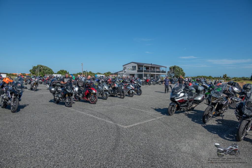
Lovely weather and extremely warm. Got my T-shirt and card and took the required photo. Now sit around and wait but it was 11:15 so would not be long. I decided to go into town and grab some lollies (diabetics best friend) and by then realised I would miss the briefing so decided to start from town and head off early.
Here some technical difficulties started. My Spot device normally takes Lithium batteries and they last ages. Could not get any so had some rechargeable batteries which Spot chews through and spits out quickly so when I stop for some time I turned it off. Well, I forgot to turn it back on so lost a few hours of tracking.
I also started my GoPro recording but it only recorded 2 seconds and switched off, which I did not see until out of town. Seems it was also recording about 1 hour out but did not notice until it was pointed out on Youtube. I restart it just out of town but that was not end of the issues for the camera.
I was doing the Hallway Tour so my first checkpoint was Ikamatua Hall, a mere 50km from the start and it did not take long to arrive and take the required photo. Always a must read of the notes to make sure you get what is required.
Rotherham hall was the second checkpoint a further 182km from the current checkpoint. I was looking at my times I was expecting to take 5 hours to do 555km. That was a very high average speed so I mucked up the spreadsheet somewhere. GPS was telling me what time it thought and it usually gets the times right.
This meant having to go over the Lewis pass which is always nice. I did notice the smell of smoke a couple of times though and when I went home Sunday there were signs saying Lewis pass was closed. Seems we timed that just right. Too many closed roads as it is as I will find out later.
So off I went and not too far in found road works under stop/go with a red light. The light was red for ages before a pilot vehicle brought traffic through. It was a huge length between the two lights and all I could see was one ute on the road which would have shaved masses of time and no need for the pilot vehicle.
A while later came across a police man who had someone pulled out. As I went past my radar detected the Ka band and continued for far longer than I thought it should. Was doing 105 so slowed down to 100 and sure enough 2 corners later another one on the left patiently waiting to catch someone. Not today my friend.
Arrived at Rotherham hall and took the required photo.
Next was a stop at Amberly to refuel. I plan my stops between 300 and 400km between them leaving enough for emergency detours. Not long after leaving Rotherham hall I noticed Spot was not on. Duh! Turned it back on and restarted the tracking.
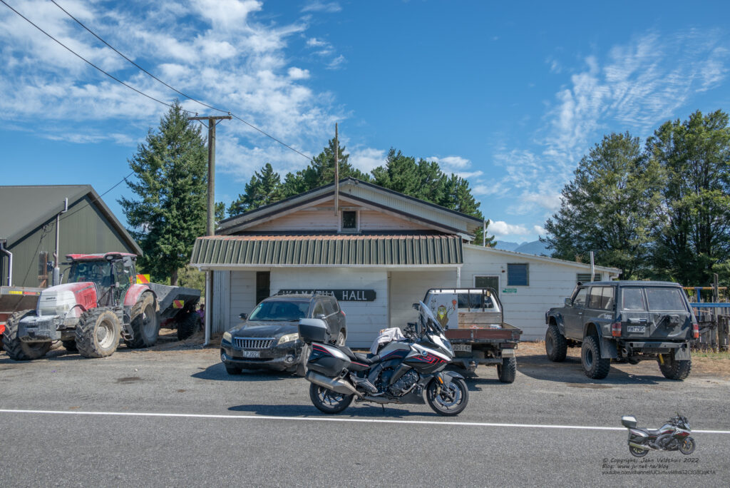
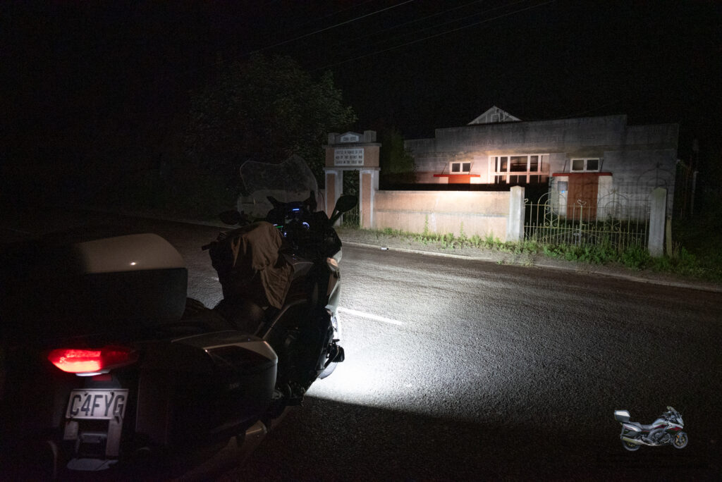
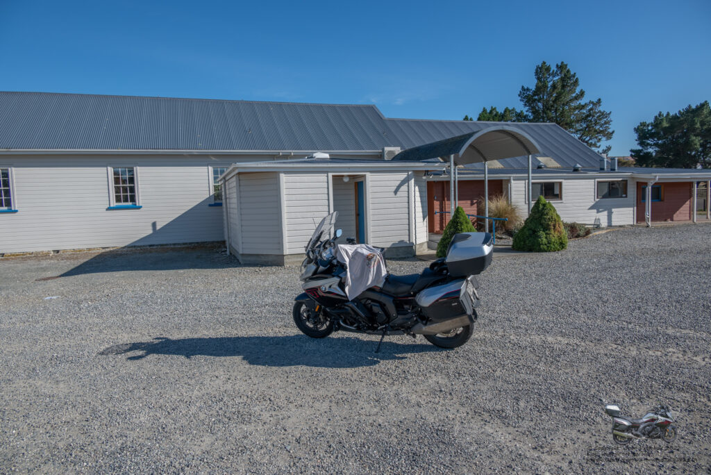
After the fuel stop in Amberly it was off to Sefton hall only 14km up the road. Arrived at the hall and parked up as three others were there. Read the instructions and was on the wrong side and couldn’t see the name. This would have failed me. Always read the instructions.
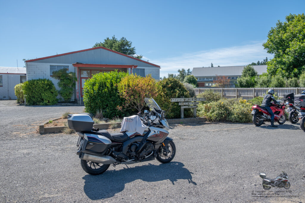
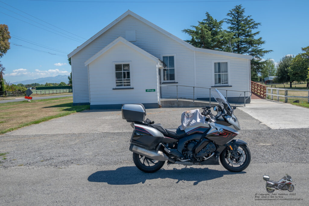
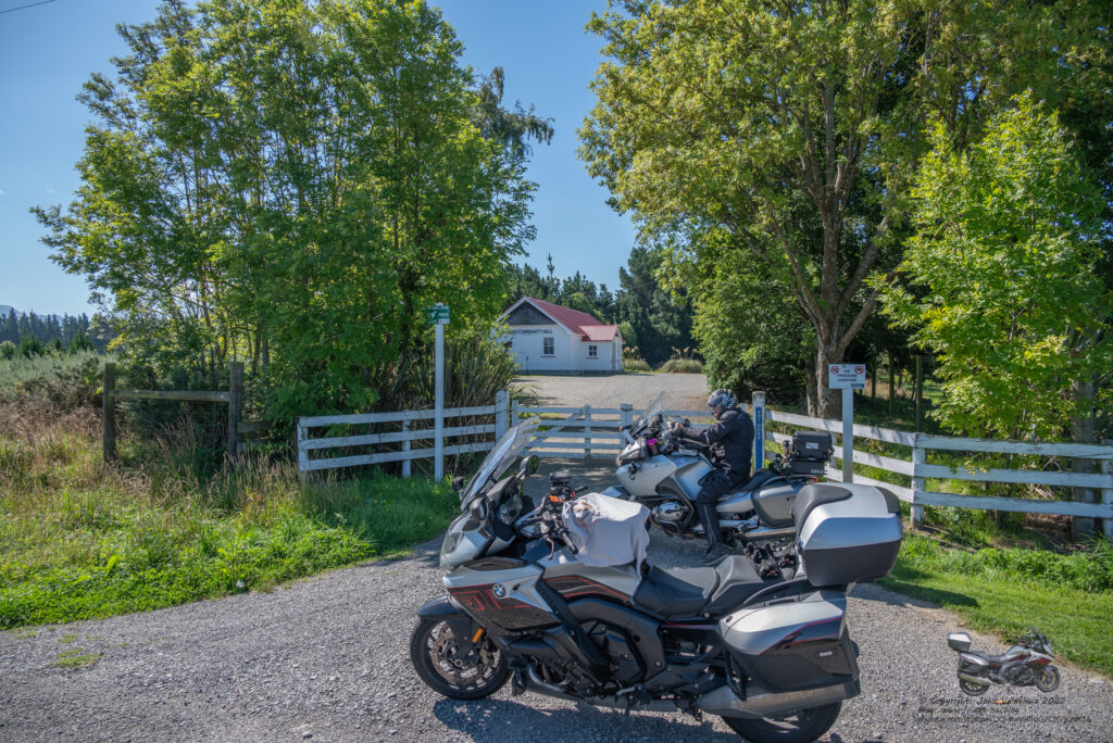
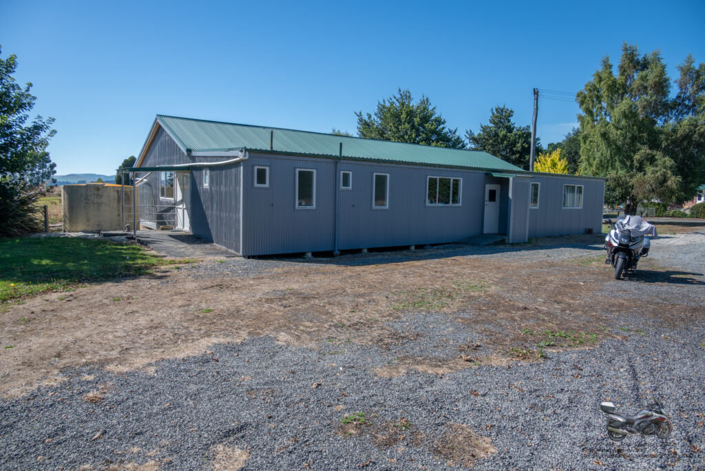
Photo done and onto the next stop at Glenroy Community Hall a further 96km distance. Nice ride in the sunny day and got to the hall. Couldn’t get close to this one as it had a closed gate but took the photo in front of the gate and was able to see the hall as per the requirement. There were two others here and just before I left a big group pulled up behind me.
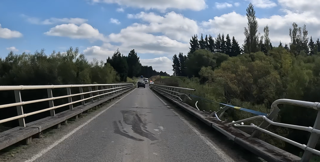
One more hall to get at Peel Forest for me for today before my overnight stay. 93km away. Not far along there were two one lane bridges. On the second one there had been an accident and on the right hand side it looked like something may have gone off the bridge. The crash rails were all bent and if it did not go off it must have been resting on the bars. Tried to see over but couldn’t. Police doing a great job and keeping the traffic flowing even though it was a one way bridge.
Just before we got to Peel Forest, three guys passed me and then overshot the right turn and had to u-turn. Photo taken.
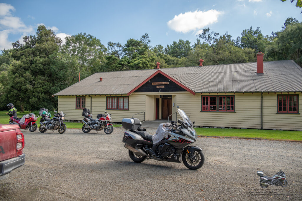
23km away was my overnight stop at Top 10 Geraldine. Here both my GPS and the track from TTHQ said to go down a gravel road. I would have if I had my new bike but not on the K1600 so went a small detour. Once at Geraldine, I fuelled up the bike and grabbed some ice, 1.5l coke and a E Mango drink. Ice was for my drinks with the coke and some pre-mix I brought from home. The Mango was for tomorrows ride. Unit was very hot but was able to get some good sleep. The burger I got for tea though was tough as old boots and not very nice. Won’t go there again.
New helmet was doing great but I am sure every single hard bug in the South Island decided to Kamikaze my helmet and it got quite messy. The audio worked well but I had to turn off the side band as it was opening every time the GPS made an announcement making me listen to wind noise as well.
Saturday 15th
Plan was to start at 3am but was wide awake by 1:45am so decided to carry on. The GoPro takes crappy images in the dark so wasn’t going to turn that on until I stopped for breakfast.
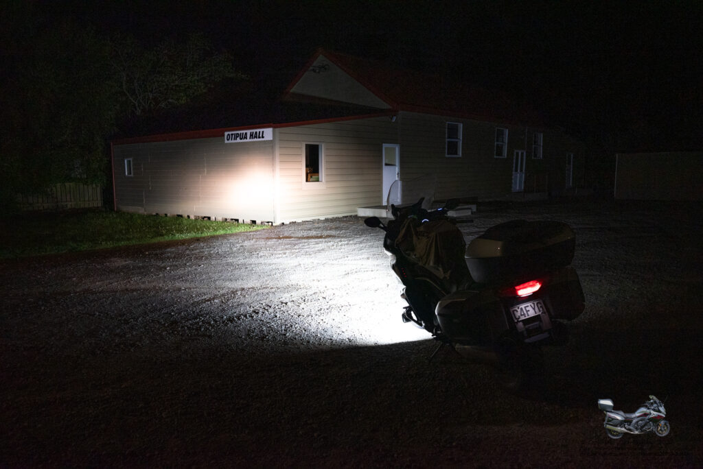
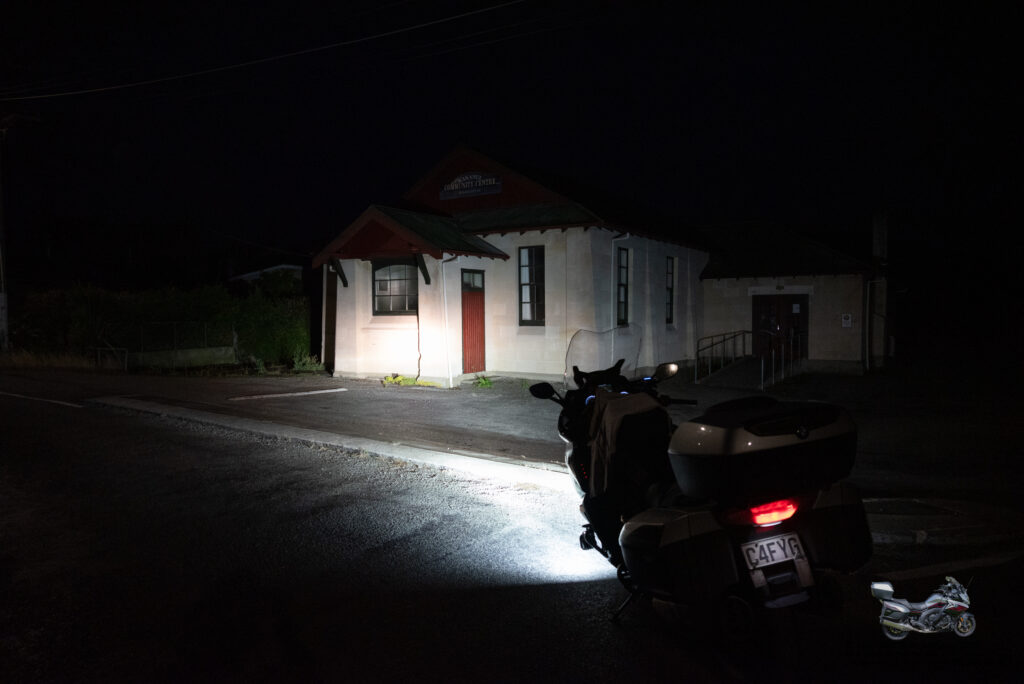
First stop for the day was Otipua Hall 45kms away. It was quite foggy out this morning but still about 17 degrees so very warm. Lined up the hall in the lights and took the photo.
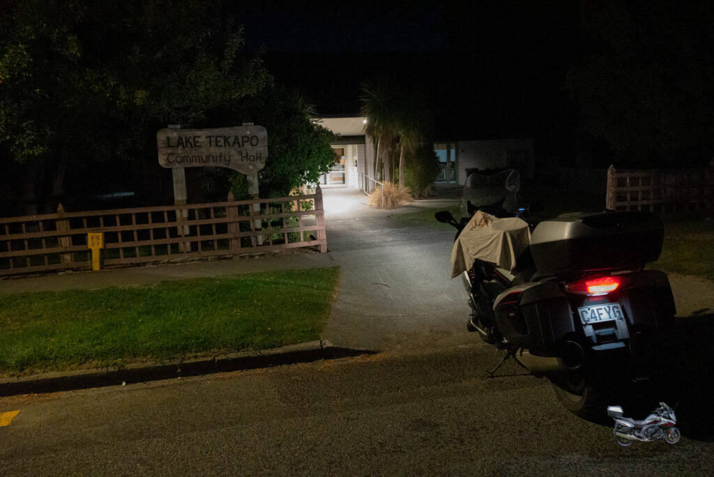
Next stop was Lake Tekapo Community hall a further 100km away. Still following the original track and timings looking better being 1 hour ahead of my schedule. Again lined up the hall in the lights and took the photo.
Next on the list was Ngapara Memorial Hall, a much further distance away at 180kms. Nice a foggy and the fairing was doing a good job of keeping me dry as the fog was very wet. Another photo lined up and taken.
Next was my first fuel stop of the day at Z Omaru and it was just before 6am. Would start looking for somewhere to have breakfast from here.
Next photo shot was Kakanui Community Hall just 12 km away from the fuel stop. Photo done
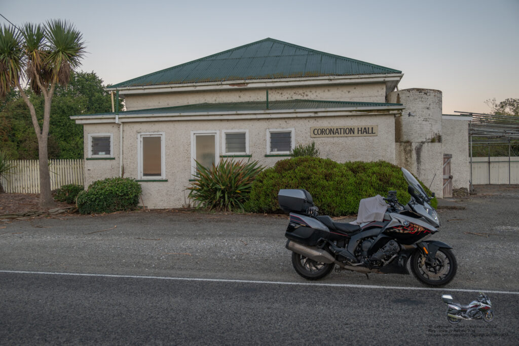
Coronation Hall was next another hour away and arrived there about 7am so plenty light enough for photos without the extra light.
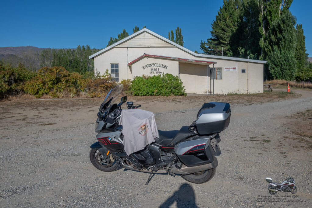
Earnscleugh Hall was 152km away and still quite foggy in places. Kept coming out of the fog only to drop back in a short time later. Arrived about 9am and was really hungry now. Grabbed some Jelly Beans to boast the sugar level up a bit just in case. Photo taken
Another fuel stop in Roxburgh and then found a café open so stopped for breakfast. Wasn’t the greatest ever had. Bacon was extra crispy and bread just about needed a chainsaw to cut but it filled a hole. After that I thought I would turn the camera back on but it said Low Power and wont not operate. I hooked it to the battery bank which seemed to be drained right down and same thing. So hooked it to my other battery bank which was fully charged but still it said Low Power. Could not get it going after 30 minutes so took it off and put it in my tank bag to look at that night. That night I did get it working but needed to take out the internal battery and reset it and then it worked again.
Millers Flat Hall was only 17km away so not long and was there taking the photo.
Kaiwera Hall was 121km away and the fog was nearly gone with long stretches of clear and arrived at about 11am. Had a bit of an issue here. I went past the turn in for the hall but saw that there was another one so took that. The car park looked like it was covered in gravel but was actually river stones and quite deep. Started to lose control on it with the front so just about stopped and then couldn’t carry on. The rear wanted to spin up, but the traction control wouldn’t let it making me just about stuck. Embarrassing to say the least. Was just about to turn the traction control off when I made it out. Parked on a firm bit and took the photo.
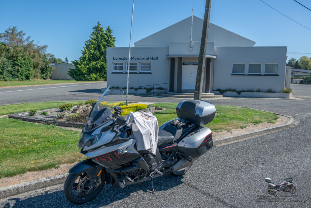
Lumsden Memorial Hall was next up 80km down the road. Photo taken.
Ohai Community Hall was next at 71km and arrived at about 1pm. Making good time and still about an hour ahead of my schedule.
Fuel stop was next at Tuatapere and at 344km since the last one. I plane my fuel legs for between 300-400km so that I have about a 100km reserve in case of issues.
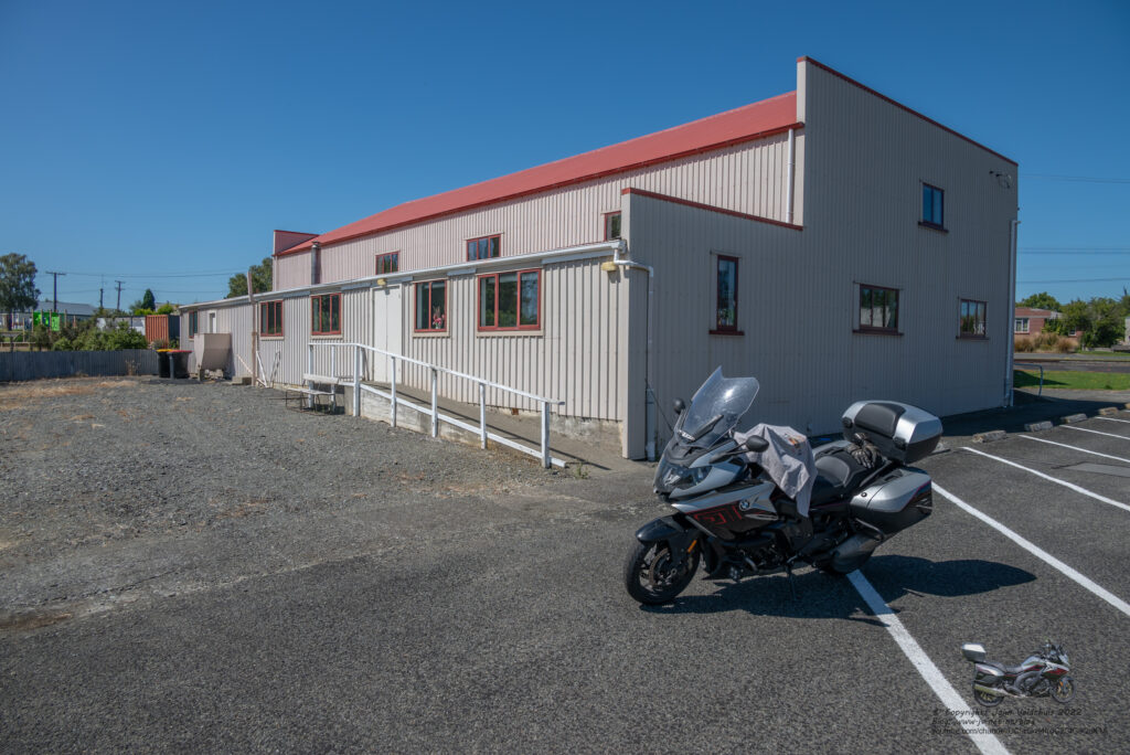
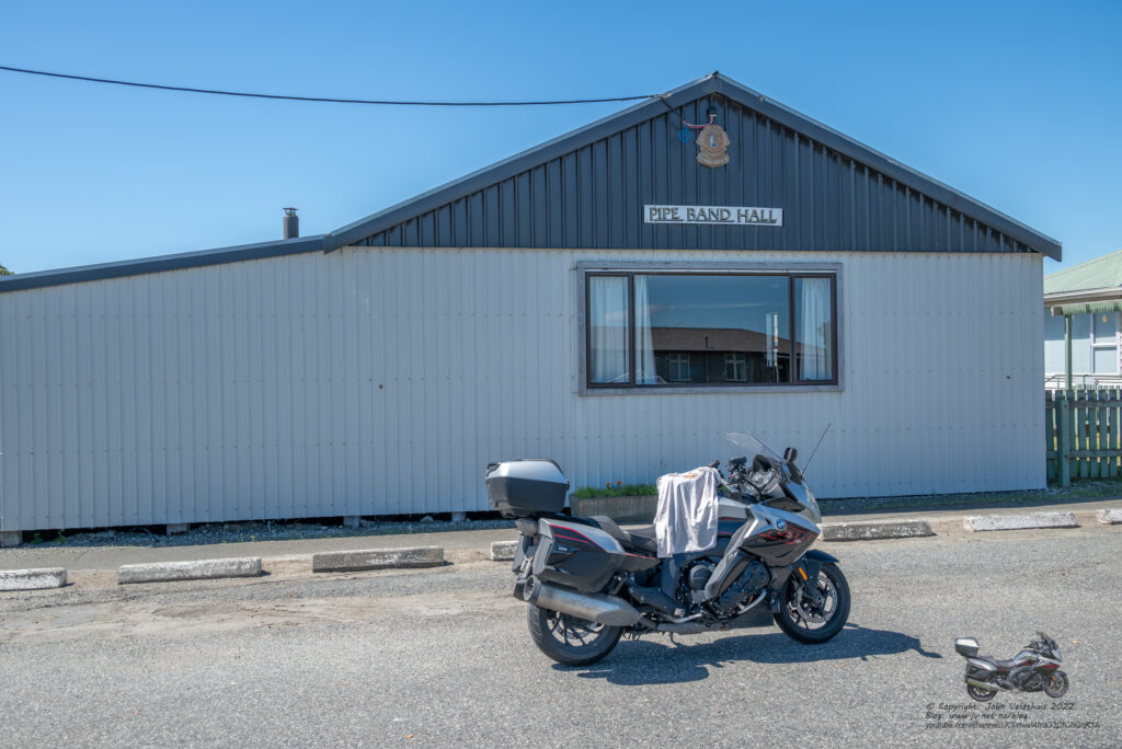
Two more stops for today and I could have a nice stopover. First Tuatapere Pipe Band Hall was up at 1km past my fuel stop
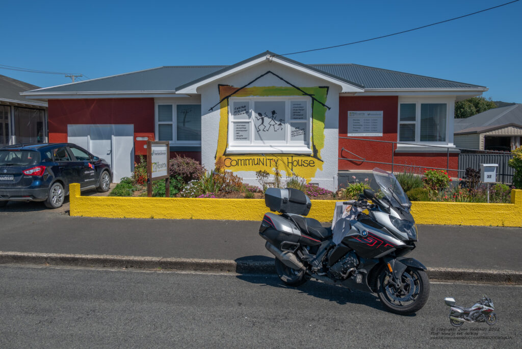
Last stop was the Riverton Community House and while I was taking my photo the neighbour came over and asked what we were doing as he had seen a number of bikes, stop, pull out tee shirts and take a photo. I explained the TT2000 to him and he was very interested.
Carried on and next stop was Invercargill Holiday Park for my overnight but first had to do some extra kms to get the right amount. Invercargill was only about 30kms away but the route took 168km to get there. Finally pulled in at about 4pm for my stop. Went to town and got some more ice, Mango drink to top up my bottle and a 1.5l coke for the drinks mix. Fish & Chips was the order for tea and I had all that and a great nights sleep.
Sunday 17th
Plan was to start at 5am and be at the finish around 8am. Plan that was going to fail badly. Woke up early again and decided to leave about 4am. This would mean hanging around a bit at the finish.
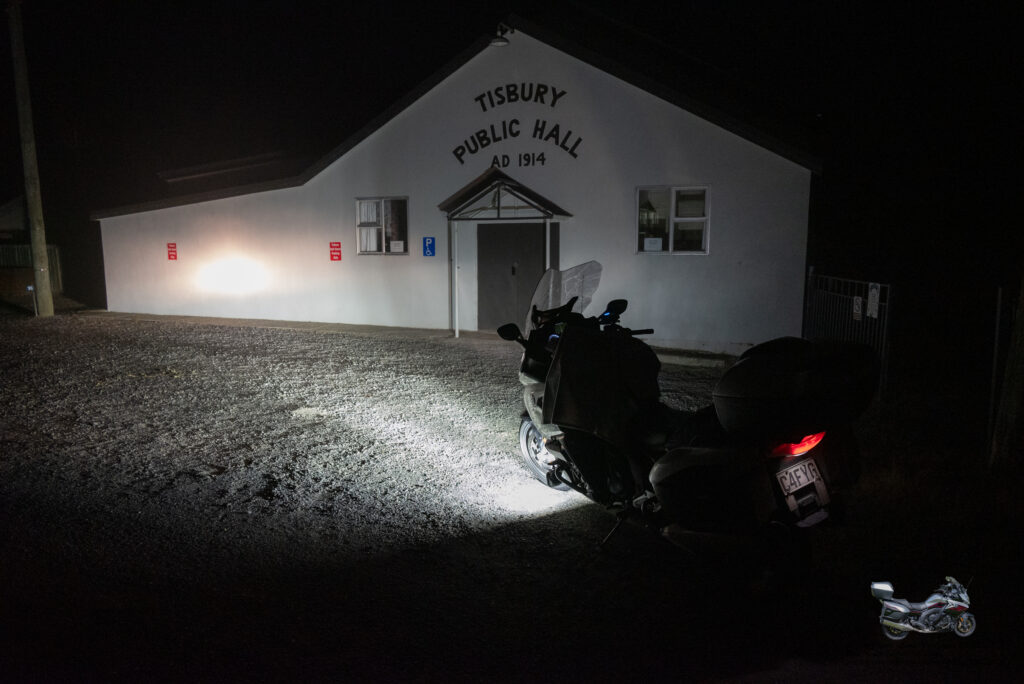
My first stop would be Tisbury Public Hall. Coming out of my unit I could see it was very foggy. Only 13km for the hall mainly through town. I had lost the track in the GSP. Must have had too many points for the GPS. Didn’t take long though and I was at the hall, lighted it up and took the photo.
Next stop was Niagara Hall and here everything went south. It was very foggy along the road, so speed was well down. About 16kms from the hall a truck loomed out of the dark that said road closed. The guy said that there was an accident, and it would be closed for at least another two hours or even more. He said I could go around via a gravel road, and I said no to that. Too foggy and in the dark on the heavy K1600 it was not an option. He then said I could go via the coastal route and to go back to Fort Road. He said it was about 15km back and would add about 31kms to my trip so headed back. After 20km I had not found the road so stopped. Tried to find it on my GPS and no luck. Tried Google Maps and still no luck. Could not see a way around on the small screen so continued heading back towards Invercargill. What the dude had actually said was Fort Rose and I worked this out later at home looking at Basecamp map. If he had said go back to the town Fort Rose I would have been good.
On the way back I flagged down another bike and He said he had tried earlier on and had hoped it was open. He said the only option was to go to SH1 and then back down adding about 200km to the trip. I punched this into my GPS when I got under some lights and it said I would not be at the finish until about 10:45am and I would not have enough time to get back to Picton to catch my ferry.
I decided then to pull out and head for Picton feeling a bit peeved. It seems the road was since about 9pm and I came through about 5:30am. Really they should have had a lane open or proper detours set up by that time. Not blaming the Police but the dudes doing traffic control slacked off.
I came through Milton about 7:30am and decided to have a quick look but no one obviously there yet at the finish so carried on. Stopped for breakfast at Waikouati and then carried on north. I rang and left a message with TT control advising them I had pulled out. Roads were extremely busy with heaps of traffic.
Just past Kaikoura, I came around a corner and could see a small car in my lane passing a car. As it got closer it was barely getting past the car and I could see that there would be an issue. I left it to the last moment to see what direction they would go, and the Asian driver suddenly yanked on the wheel to the left, nearly crashing into the car he was passing. I went for my left. I caught this on the GoPro but the Timewarp does not do it justice and it does not look as bad as it was.
Arrived at the ferry just before 5pm and loaded up at 6pm for my trip back. Arrived in Wellington and came off the ferry onto SH1. Didn’t get far before the road was again closed and we had to go via the back streets of Johnsonville following two big trucks. They took up nearly both lanes so passing was out of the question. God help any cars coming the other way but there were none. Finally got back on the motorway and carried on.
Very windy on the Foxton straight and more road works just before Wanganui.
Not long out of Wanganui and the GPS suddenly said 10 minutes had been added to my journey time but would not say why. Soon after I remembered the roads at Waitotara along the straight and sure enough the whole straight was ripped up.
Finally arrived home at 2:40am so made good time of 2hrs 40minutes from Wellington. All those expressways have shaved nearly 30 minutes off the trip.
Anyway, it was a good trip and as always well set up by team. My planning let me down in the end by not having a backup plan and cutting my times too fine. It won’t happen next year as I will be retiring soon and will have plenty of time and not have to worry about finding someone to do my shifts.
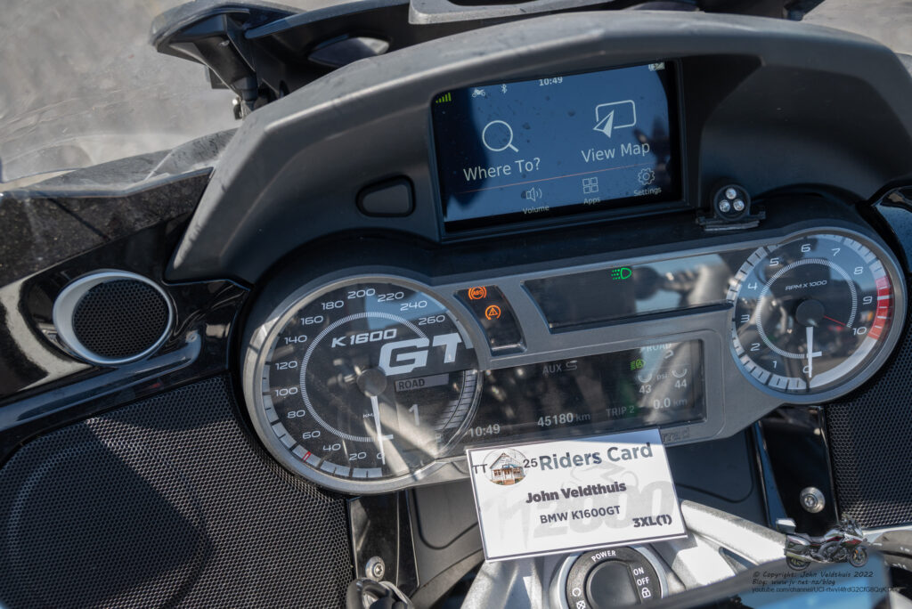
Also, this was the last ride of the BMW K1600GT. It is a lovely bike which is smooth to ride but it is heavy. You don’t notice it while it is moving but slow speed stuff and stopped you notice it. Picking it up after dropping it is a mission in itself and I nearly pushed it off the side stand closing the pannier.
New bike has been ordered and will be a BMW R1300GS Adventure ASA. Unfortunately, it won’t be here until August so am going to be unable to do any riding until then.
A Youtube video of Friday is below. There will also be a video of the return to Picton at some point.
What a great trip John. Very interesting read. Good to c u ok. All the best with your new bike.