Time again for the NI800 and with covid threatening to curtail then event the organisers made a few different routes and settled on a southern route due to Waikato being in the zone.
Also threatening the curtail the ride for me was my surgeon. After my accident in January my wrist was still giving me hell and an MRI confirmed my left radius had been squashed up a bit and now my ulnar was 2-3 mm too long. Topping that off my TFCC (Triangular fibrocartilage) was torn to bits and some of it between the bones causing the pain. The TFCC is the ligament that holds things togeather. So, surgery to shorten my ulnar and repair the ligament is going happen but didn’t know when.
For those reasons I decided to do the NI800 virtual ride meaning I could do it when ever I wanted to.
I decided to do it the next day after the actual ride given, I still didn’t have my date and the weather was not looking too bad. Programmed up the GPS, put on the brand-new tank bag for the K1600, mounted the Go Pro Hero 9 which still had not been used, and got ready to leave home about 4am.
I woke early and watched the Formula 1 qualifying before departing home at 4am. I turned spot on and was off into the dark. Wait a minute, I could not see properly and had left my glasses on the bench. I do that sometimes. Lucky I only made it a few meters and went back and got them.
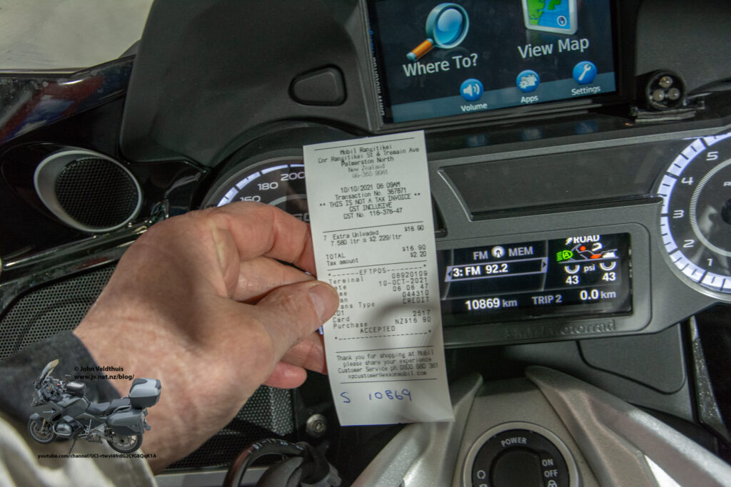
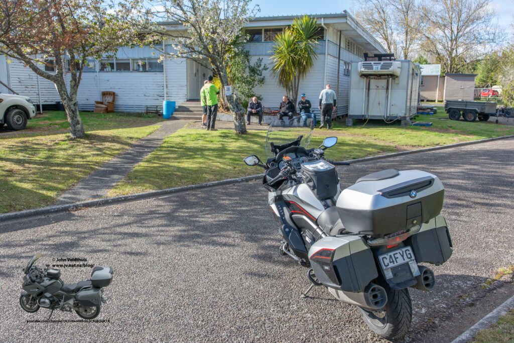
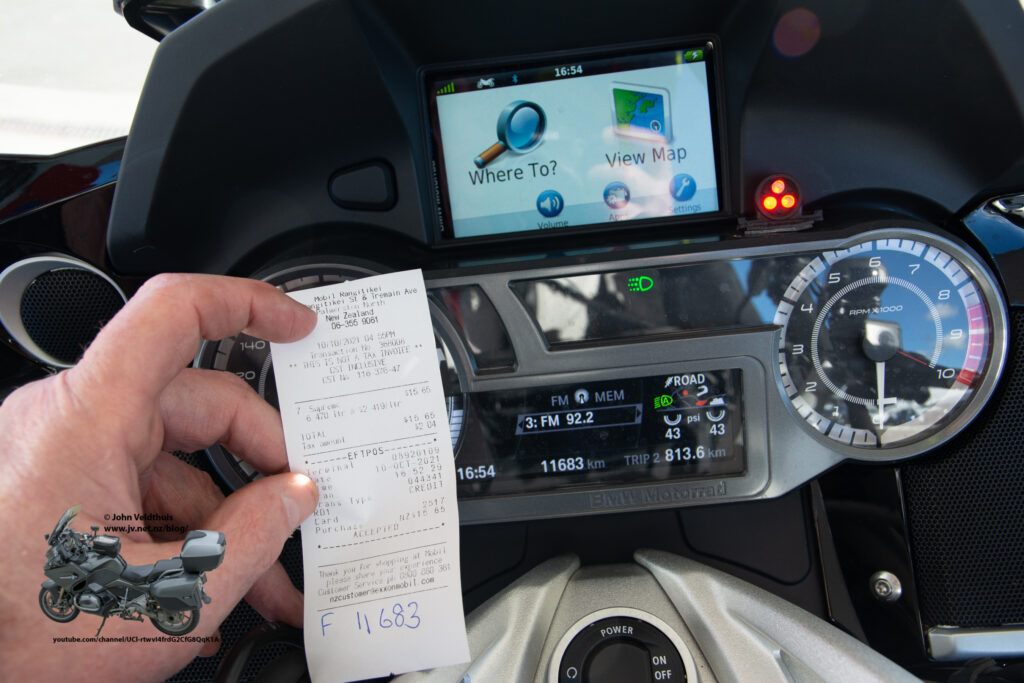
Nice cruise down to Palmerston North where I had decided I would start my NI800. Nice thing about the virtual ride is being able to start at any place. Filled up at the Mobil station and got my receipt which I took a photograph with the odometer. Also took a selfie which was a requirement. Took a few minutes to get the Go Pro working on Time warp mode. It did not want to connect to my phone for some reason. I have it connected to a battery in my tank bag. The powerlet connection on the bike is used to charge that battery so can record until the card fills up.
Set off just after 6am and the GPS telling me I would be back here at 15:13.
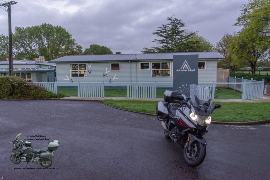
First stop was just out of town at Aokoutere School. This was actually Checkpoint 7 but for me it was number 1. Nearly missed it because the sign had been changed since the notes photo was taken but the brakes on the big K1600GT were excellent and I pulled in for the first photo.
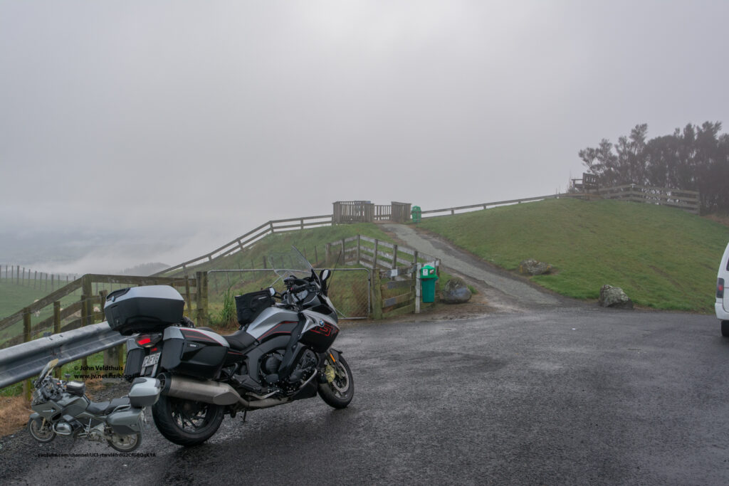
Second stop was the Stormy Point Lookout (CP8) and I had to use a couple of shaping points here to get the GPS to follow the route. The road was damp and just before I got to the lookout, I could see a big low hanging cloud and quickly I was into it with reduced visibility. A van was overnighting at the checkpoint as I took the photo, and relieved a bit of pressure. Hope I did not wake them as I took off for the next photo. Turns out the van was left there and by Monday someone had stolen all 4 wheels off it.
Bit of a long stretch this one as I had to get to the Turangi Start/Finish point. It was getting cold and by the time I got to Waiouru I had to stop and put the heated jacket on as the heated grips and heated seat were just not doing it. Feeling much better I headed along the desert road. A truckie coming towards me flashed his lights and feeling he was just being a wanker I lit up my high beams. This has the twin headlights and also the two Denali Led lights each of which put out 4000 lumens. Even though it was quite light outside I still lit up the inside of his truck. Finally got the the Turangi base and a few people around. Had a quick chat with someone about what I was doing then carried on as I had quite a way to go.
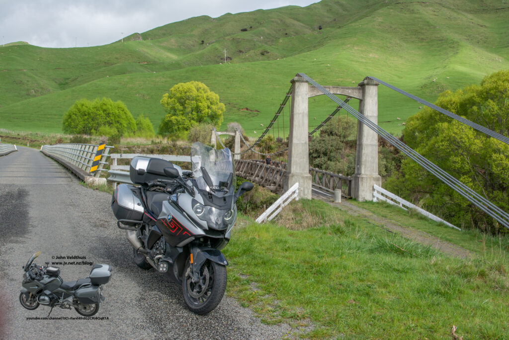
Next stop was Springvale bridge on the Gentle Annie, but I had barley got out on the road when I spotted my camera was facing down. Not sure when it happened but hoped off and straighten back up and gave it a bit more muscle on the screw (it went down ¾ way along the desert road). Filled up at Waiouru and was soon into the twisty’s of the Gentle Annie. Came up to the bridge and took the photo.
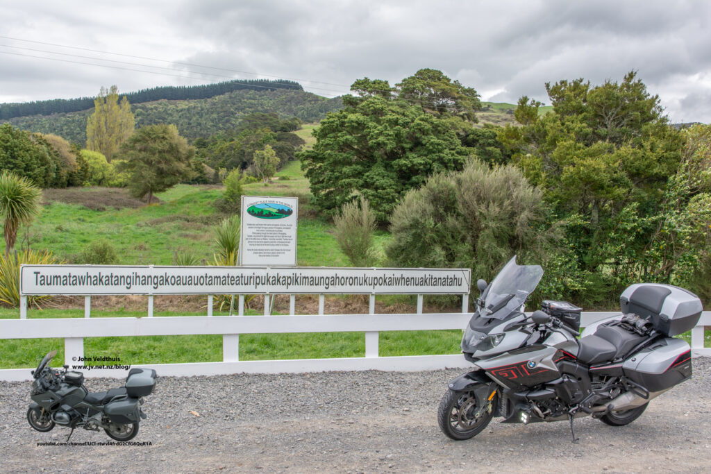
Next stop was the longest place name. A sign with the worlds longest place name. First though was the rest of the twisty’s and it was starting to give my wrist a bit of pain. Topping that off it started to rain with quite big drops, and it seemed to be hanging over me. I could see blue skies but couldn’t quite get to them. However, by the time I got to the main road I was in sunshine again a drying out quickly with the strong winds. Photo taken after some quite horrible road state and some road works.
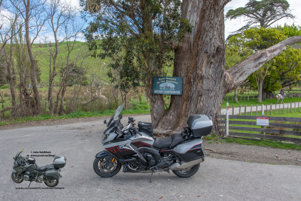
Next stop was Dittons Road and a picture of a sign in the tree. Quite nice roads and sun was out and I was starting to get a bit warm with the heated jacket still on so I unplugged it. Couple of big gusts of wind had me moving around the road a bit. Soon can upon the checkpoint and took the picture.
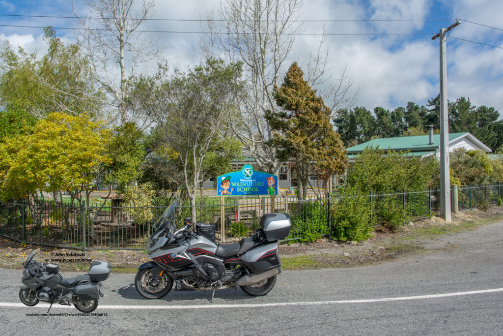
Wainuioru School was the next checkpoint, and the GPS was working well up to this point. No issues finding the school and the roads still good. After taking the photo the bike had turned itself off and when I left the GPS was on the main menu page but knew it would change soon. Off down the road only to be told quite rudely to make a U-Turn as soon as possible. Checked the GPS and yep I went the wrong way and should have taken the turn.
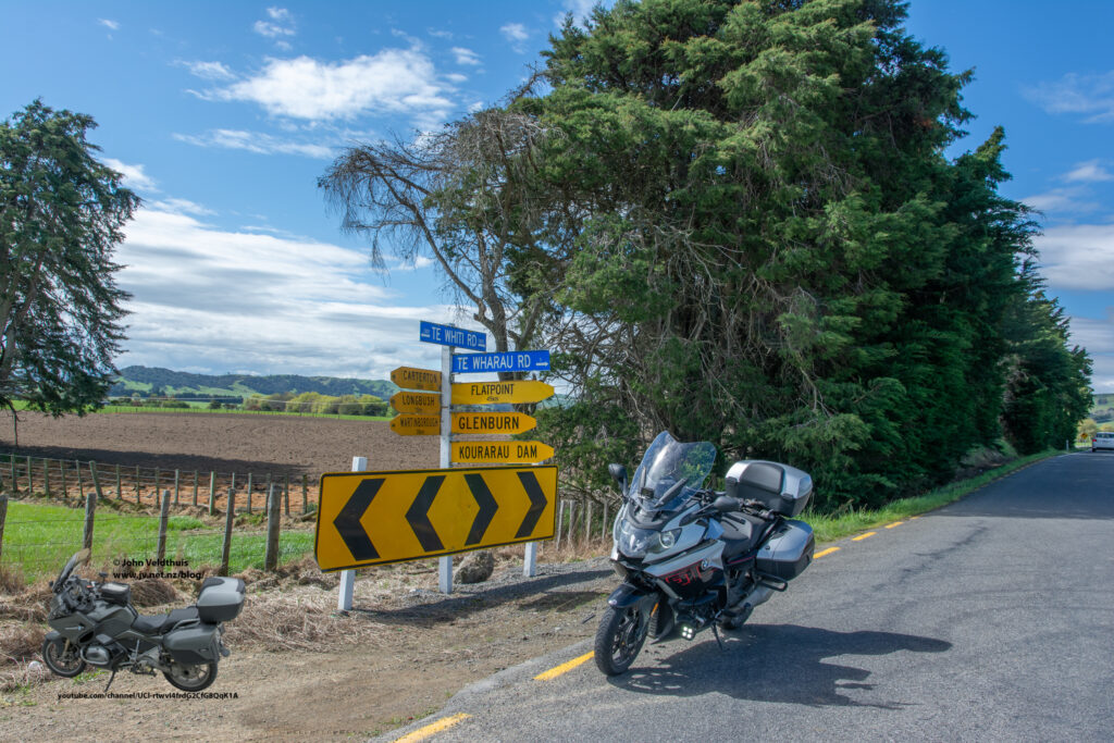
Quick U-Turn and I was soon back on track to Te Whiti Road. This was quite a busy corner and quite a camber on the road edge, so I turned to face the traffic and quickly took the photo.
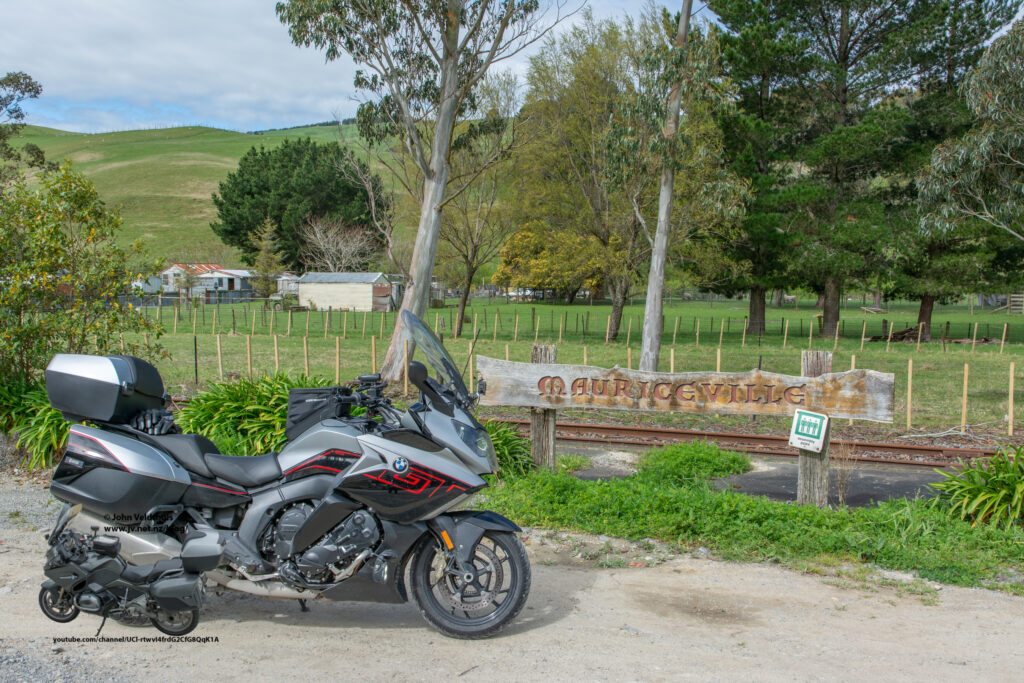
One last checkpoint to get at Mauriceville but first a quick stop in Masterton to refill the bike. The K1600GT has a slightly bigger tank at 26.5 litres than the R1200RT at 25 litres but it does chew through it at a higher rate so means less km’s per tank in the end. Must be those 6 cylinders. Anyway, quickly found Mauriceville but missed the sign and had to do another U-Turn to find it on the other side of the road. Photo taken and just the ride home.
Now the GPS started playing silly buggers. I headed in the original direction, but GPS said it was faster the way I had been going so turn around and went that way. A short distance though the road look very narrow so decided to go the original way. GPS said 3 minutes longer but whatever. Soon though it told me to turn right and just before I got to the corner it said to turn onto the unpaved road. Had the GPS set to avoid those roads and had a look at it and it was sealed so started down it. Quickly though it went to gravel so cursed the GPS and turned around. It recalculated and said the route now would be another two minutes longer. Not sure why the GPS wants to keep putting me on gravel roads. Soon back on SH2 and then the left turn to Tutaekara Road to go over The Track and then back into Palmerston North. Quick stop at Burger King for some food and drink and then across the road to the Mobil fuel stop to finish the ride with another photo of the odometer.
Had another two-hour ride home but was home by 7pm with another NI800 under the belt.
Thanks to the organisers for managing to get a ride in under the covid conditions. Had rode most of the roads before and getting harder to find ones that I have not been over before.
I do have a video but unfortunately the GPS data did not get written. It is a timewarp from my GoPro Hero 9. I will upload it once I have spliced it togeather.